
PROJECT: |
Oil Spill Response - Marsh Oiling |
LOCATION: |
(Witheld) |
DATE: |
(Witheld) |
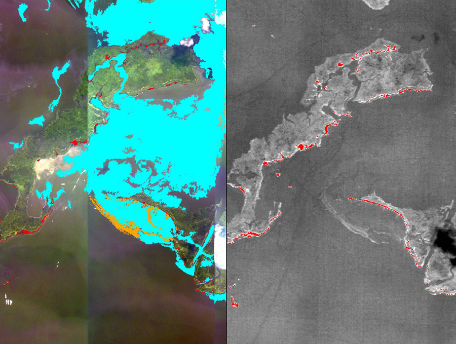
A combination of specially chosen multispectral visible wavelength bands (left) and thermal imagery (right) allows Ocean Imaging to map oil within marsh areas and classify its state and concentration. Here thick, beached oil is highlighted in red and can be mapped even deep within the marsh channels.