
PROJECT: |
Wetland Mapping - NDVI Change |
LOCATION: |
Undisclosed Location, California |
DATE: |
2006 |
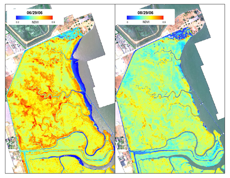
The use of multispectral aerial imagery for vegetation mapping provides much greater detail than is possible from satellites. We usually image vegetated areas at resolutions between 30cm and 1m, depending on the type of final product desired. The ability to choose specific wavelengths for our DMSC's 4 channels maximizes classification efficiency and accuracy. We often have enough spectral detail to separate individual species.