
PROJECT: |
Bottom Substrate Mapping |
LOCATION: |
San Diego, CA |
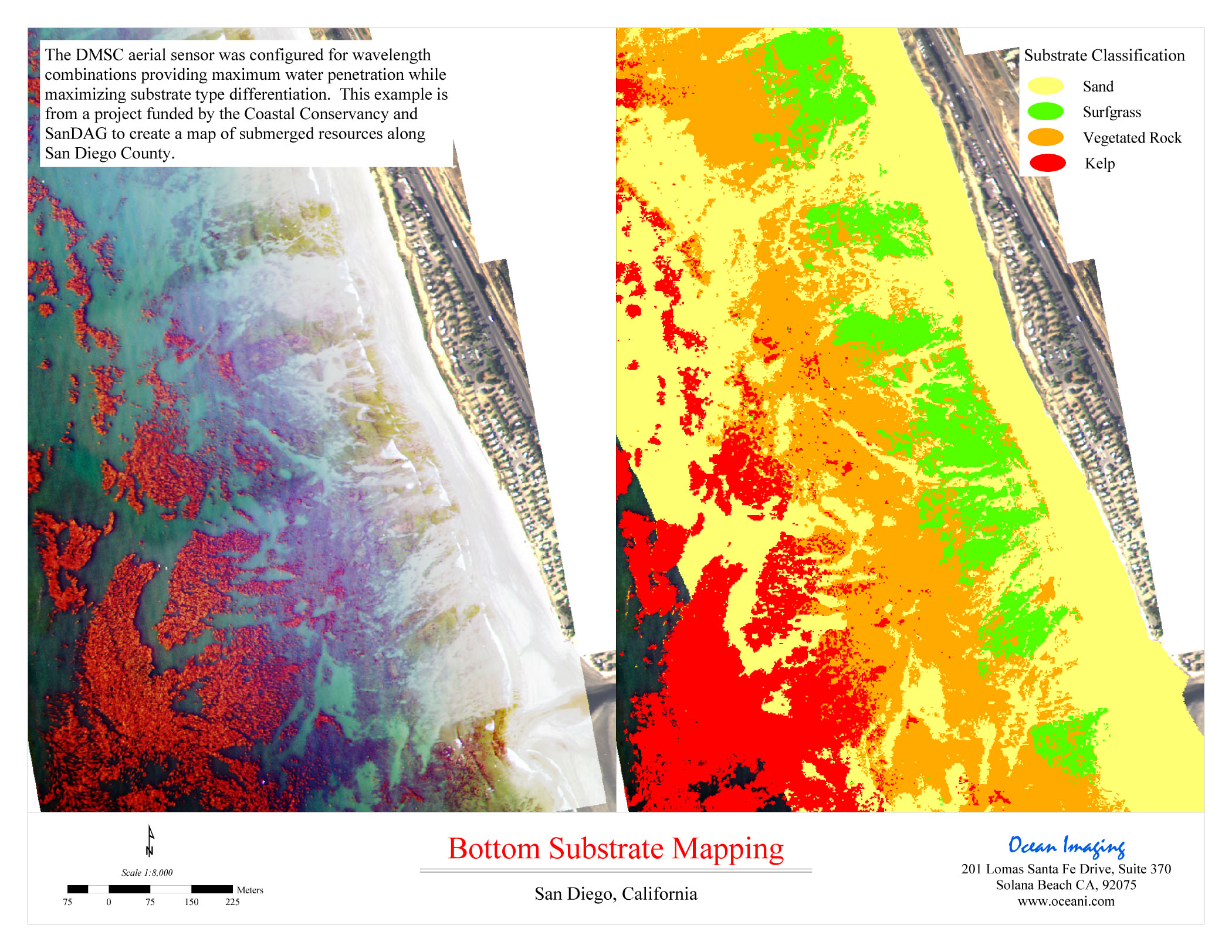
The DMSC aerial sensor was configured for wavelength combinations providing maximum water penetration while maximizing substrate type differentiation. This example is from a project funded by Coastal Conservancy and SanDAG to create a map of submerged resources along San Diego County.