
PROJECT: |
Oil Spill Response - Land-based Spill Mapping Example |
LOCATION: |
(Witheld) |
DATE: |
(Witheld) |
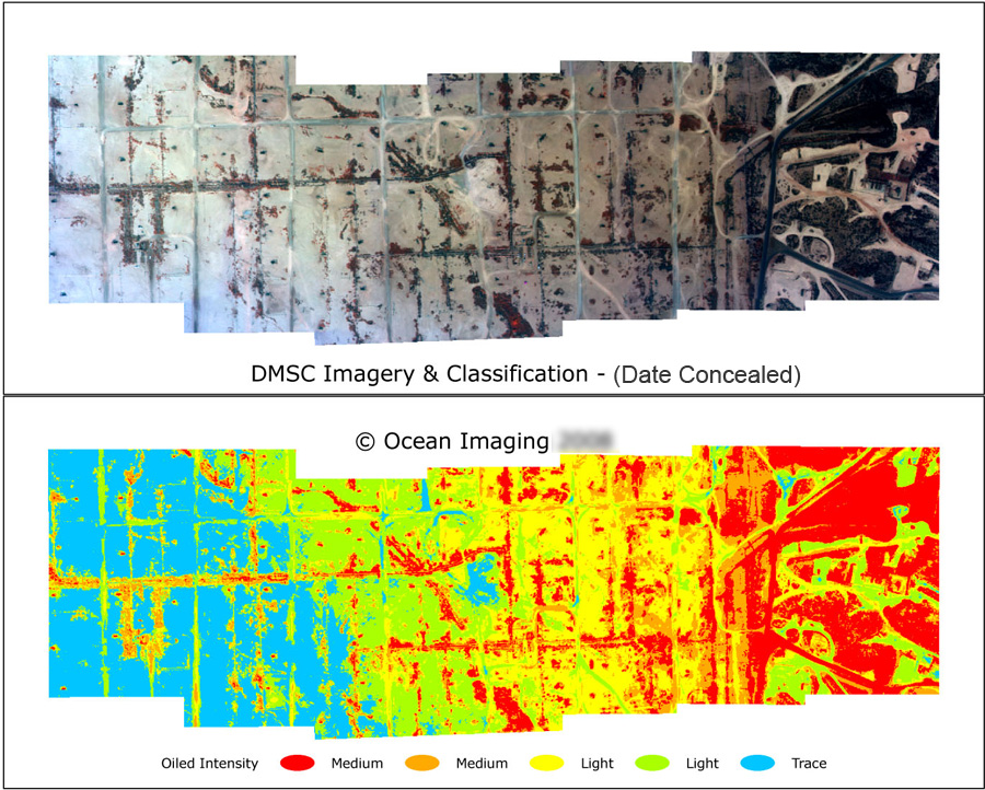
A land-based well blow-out caused crude oil to be sprayed on the surrounding landscape. Ocean Imaging used specially configured aerial multispectral imaging to map the oil coverage extents and quantify its severity.