
PROJECT: |
Intertidal Habitat Mapping |
LOCATION: |
Morro Bay, California |
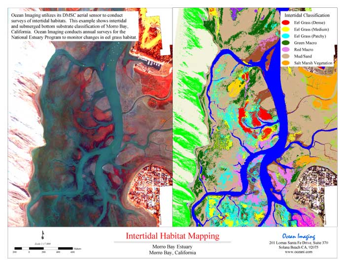
Ocean Imaging utilized its DMSC aerial sensor to conduct surveys of intertidal habitats. This example shows intertidal and submerged bottom substrate classification of Morro Bay, California. Ocean Imaging conducts annual surveys for the National Estuary Program to monitor changes in eel grass habitat.